

This page includes links to products on Amazon. As an Amazon Associate I earn from qualifying purchases.
The Great
Chicago Fire
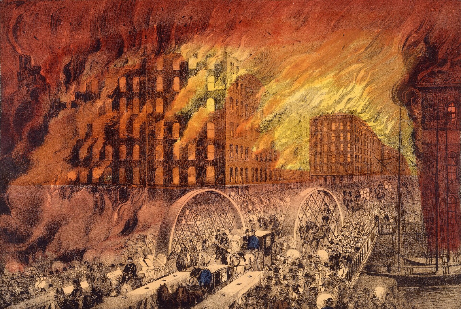
On the night of October 8, 1871, a fire that began in a barn on Chicago’s West Side burned for some thirty hours, crossed the river twice, and consumed the heart of the city. The world knows it as the Great Chicago Fire.
This page lays the whole event out: what the fire took, what caused it, a map of its path, the hour-by-hour timeline, the deadlier fire that struck Wisconsin the same night, and the six places where 1871 is still part of daily Chicago. The three-year fight over the rebuilding has its own page.
.jpg?width=1600)
The Reckoning
What the fire took
The Tinderbox
What caused the Great Chicago Fire?
Nobody knows what lit it, and the famous cow was a reporter’s invention. What turned a barn fire on DeKoven Street into a disaster is on the record: Chicago in October 1871 was parched, built largely of wood and guarded by an exhausted fire department, and a hot southwest wind drove the flames northeast toward the business district. The figures below follow the National Weather Service’s reconstruction of that autumn and contemporary accounts of the department’s week.
Taken together, those conditions amount to an argument about the whole disaster — an argument, because nobody can prove it. A spark explains how the fire started. The drought, the timber, the wind and the worn-out department explain why it did not stop. That is why the question Chicago has argued over for more than 150 years — who lit it — may be the least useful one to ask.
The Path of the Flames
How the fire moved across the city
A river should have stopped it. Instead, driven by a hot southwest wind, the fire crossed the Chicago River twice — over the South Branch into the business district, then over the Main Branch into the North Side — and ran until it met open prairie, the lakeshore, and rain. It could do that because the water was about the only thing on the river that would not burn. The banks carried lumberyards, coal heaps, gasworks and wooden bridges, and the wind threw embers far enough ahead to find them. The shaded band is an approximate outline of the burned district; the river and shoreline are drawn from real geographic coordinates.
The burn outline is approximate, drawn to the extent the standard histories describe, from DeKoven Street to Fullerton Avenue. The 1871 shoreline lay somewhat west of today’s — much of the modern lakefront is landfill, some of it fire debris pushed into the lake.
Hour by Hour
Thirty hours, October 8–10
A fire in the barn
Flames break out in or near a barn behind the O’Leary cottage at 137 DeKoven Street, in a dense West Side ward of wood cottages, sheds, and fences — after one of the driest summers on record.
The alarm goes wrong
A watchman misjudges the location and sends an alarm to the wrong district. Crews — already worn out from a large fire the night before — arrive late to a blaze the wind has taken hold of.
Across the South Branch
Wind-borne embers vault the South Branch of the Chicago River, igniting the gasworks and the mills and setting the central business district alight.
The courthouse falls
The domed county courthouse burns; its great bell crashes through the collapsing tower. Prisoners in the basement jail are released to flee.
Into the North Side
The fire jumps the Main Branch of the river into the North Division. When the waterworks burns, the city’s pumps fail — and with them, any hope of fighting the flames.
The North Side consumed
Block after block of mansions and workers’ housing burns northward. Tens of thousands flee toward the lake and the open prairie, carrying what they can.
Rain, and the end
A light rain begins as the fire reaches Fullerton Avenue — then the city limit — and burns itself out against prairie and lakeshore. The great fire is over.

The Same Night
The deadlier fire that same night
Two hundred and fifty miles north, the same drought and the same dry wind did something far worse. On the very night Chicago caught, the lumber town of Peshtigo, Wisconsin, and the forests around it were swallowed by a firestorm that remains the deadliest wildfire in American history. It is far less remembered, and not only because Chicago burned the same night and took the headlines. Peshtigo was a remote lumber town, and the records that would have counted its dead burned along with them — which is why its toll survives only as a range.
Chicago, Illinois
~300
dead · about 2,112 acres · remembered the world over, its name a byword for catastrophe and comeback.
Peshtigo & the north woods
1,200–2,400
dead across the region, of whom perhaps 500 to 800 died in Peshtigo itself — about half the town · roughly 1.2 million acres · the deadliest wildfire in U.S. history, and far less remembered.
Set the two tolls side by side and a question forms. How did Chicago lose a third of itself and perhaps three hundred lives, while a far smaller town lost something like half its people in a single evening? The difference is mostly pace and escape. Chicago burned for some thirty hours, travelling in one direction, with a lake at its back and open prairie beyond it — tens of thousands simply walked out ahead of the flames. Peshtigo was overrun in a night, in forest, by a fire that made its own wind. The only refuge, survivors said, was the Peshtigo River itself.
The two were not alone either. That same night, fires also tore through Michigan — Port Huron, Holland, Manistee. Historians group them as the Great Fires of 1871. So why did half the upper Midwest burn on one evening? The shared date has fed a durable theory that fragments of a passing comet did it. The duller answer is the documented one. What lit each fire is mostly unknown, but the same parched autumn and the same dry wind made every one of them hard to stop, on a landscape that had been waiting all summer for a match.
The Comeback
Chicago’s growth slowed in the fire decade. It did not stop.
A third of Chicago was ash. It could have been the end, and it was not: the city counted about 299,000 people the year before the fire, over 500,000 by 1880, and more than a million by 1890. The tidy version of that story — the fire as the making of the city — does not survive the arithmetic below. The census shows no fire-driven boom.
Read the rates, not the bars. The columns climb, so the chart looks like a city accelerating. The percentages say something more interesting. Chicago added 167 percent in the 1860s, then 68 percent in the decade of the fire — its slowest stretch to that point — then 119 percent in the rebuilt 1880s. What the numbers show is a city that kept growing through the fire decade, more slowly than before, and then sped up again in the 1880s.
The Cow & the Rebuilding
The unsolved cause, and the city rebuilt in stone
Was it Mrs. O’Leary’s cow?
No. A reporter admitted decades later that he invented Mrs. O’Leary’s cow and its kicked lantern for a livelier story, and in 1997 the City Council formally exonerated her. Debunking the cow, though, did not solve the case. The fire began in or beside the O’Leary barn on DeKoven Street; who or what lit it has never been settled. Suspicion has since fallen on the neighbor who raised the first alarm and on young men said to have been gambling in the barn that night. The official cause remains unknown.
A city rebuilt in stone
Relief poured in from across the nation and the world. Within a generation Chicago rebuilt bigger and less flammable — new fire codes, brick and steel, and an architecture of ambition. The rebuilding boom set the stage for the steel-framed skyscraper and the 1893 World’s Columbian Exposition.
The fire is still here
More than 150 years on, this is not a story Chicago has to go looking for. Six pieces of it are part of the everyday city.
You stand on it
Grant Park
The city dumped the burned rubble — lumber, broken glass, ruined furniture — into the lake east of Michigan Avenue, roughly between Randolph and Roosevelt. That fill, later covered with soil, became the first ground of Grant Park; more landfill over the next half-century pushed the park farther into the lake.
You carry it
The second star
Of the four red stars on the city flag, the second one is this fire. Wallace Rice’s original design had only two stars — the fire and the 1893 World’s Fair. It was one of just two events Chicago first chose to represent itself with.
You walk the scar
The Loop and beyond
The 2,112 acres that burned are now the Loop, River North, Streeterville and the Gold Coast — the densest and most valuable ground in the city. The district that burned is now the part of the city visitors come to see.
The origin
137 DeKoven Street
The barn where it began. The site is now the Robert J. Quinn Fire Academy, built in 1961 — the city trains its firefighters on the spot where the fire started, marked by a bronze “Pillar of Fire.”
The survivor
The Old Water Tower
One of the few public buildings left standing in the burned district. It still stands on Michigan Avenue, a limestone landmark ringed by the towers of the city that grew up around it.
From the ashes
A library from abroad
The fire burned an estimated two to three million books. England shipped some 7,000 to 8,000 to replace them — volumes from Queen Victoria, Tennyson and Disraeli among them — and they became the founding collection of the Chicago Public Library.
“Chicago Shall Rise Again.”Rallying cry of the rebuilding, 1871
Sources & method. Toll figures follow standard histories (the Chicago History Museum’s Great Chicago Fire & the Web of Memory project) and are widely cited estimates, not exact counts; the death toll of roughly 300 is an official estimate long thought low, since many bodies were never recovered. Reputable sources genuinely disagree on several figures — damages are put at $200 million by most histories and $222 million by the National Weather Service, the burned area at 2,112 acres by most histories and 2,124 by the Weather Service, and the city’s 1871 population at somewhere between 300,000 and 334,000. Where sources conflict we say so, and the headline figures are the most widely cited ones. The drought figures and fire-weather detail are from the National Weather Service’s reconstruction of October 1871; the fire department’s week, including the Saturday-night fire and the failed alarm, is from the Chicago History Museum’s account of the conflagration and contemporary reports. The unresolved cause and the named suspects are set out by Time. The Peshtigo fire is documented by the National Weather Service and History.com; the wider Great Fires of 1871 by standard histories. Population figures are from the U.S. Census (1860–1900). The origin site, Water Tower, and the library’s founding donation are documented by the City of Chicago, the Chicago Public Library and WTTW, which also gives the estimate of books lost. Grant Park’s origin as fire landfill is documented by WTTW and the Chicago Public Library; the flag’s second star is the city’s own published symbolism. The river, lakeshore, and city geography are drawn from real coordinates; the burn district is an approximate outline drawn from the extent the standard histories describe.
ON AMAZON
Books on the Great Chicago Fire
- Chicago's Great Fire: The Destruction and Resurrection of an Iconic American City, by Carl Smith. A history of the fire and the rebuilding.
- The Great Fire, by Jim Murphy. A nonfiction account written for younger readers.
- The Great Chicago Fire (Images of America), by John Boda. A photographic history in the Images of America series.
- I Survived the Great Chicago Fire, 1871, by Lauren Tarshis. A novel for children in the I Survived series.
Chicago gifts
- MasterPieces Chicago Puzzle 1000 Piece Panoramic Skyline Jigsaw. A 1,000-piece panoramic Chicago skyline puzzle.
- ANLEY Fly Breeze 3×5 Foot City of Chicago Flag. A 3-by-5-foot City of Chicago flag.
- Trope Chicago, by Sam Landers and Tom Maday. A coffee-table book of Chicago.
As an Amazon Associate I earn from qualifying purchases.
Reported by KCM Desk from the National Weather Service’s reconstruction of October 1871 and the standard histories; published July 24, 2026. Human-guided and edited — about this desk. If you spot an error, corrections come first.
Related Keep Chicagoland Moving coverage
- After the Great Chicago Fire: the Three-Year Fight Over Who Could Rebuild
- Chicago’s Tax Rolls Show 7,875 Fewer Two-to-Six-Flats Than in 2006. Of the 13,049 Parcels That Left the Count, 6,208 Are Now Classed as Single-Family Houses.
- Chicago Still Budgets 200 Building Inspectors. It Writes Half as Many Violations as in 2018.
- One Map, Three Chicagos: Where the City Builds, Opens, and Rides